According to new European drone regulations, UAS geographical zones (so-called “geozones”) have been created since 31 December 2020. These zones are only accessible to drones complying with technical and operational criteria as well as restrictions with regard to the use of these drones. Therefore, skeyes implemented a web application to facilitate planning, coordination and information flow procedures between drone operators/pilots and Air Traffic Control.
This new application, Drone Service Application (DSA), was designed by SkeyDrone, a daughter company of skeyes. It serves two main objectives :
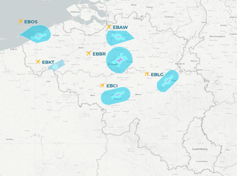
These zones are the controlled airspaces around the airports of:

for Beyond Visual Line Of Sight (BVLOS) flights;
if the DSA tool is inaccessible for technical reasons.
If the above conditions are not met, your flight authorization request will not be processed. Please use the adequate DSA tool instead.
DRONE SERVICE APPLICATION FORM
DSA QUICKSTART GUIDE FOR OPERATORS/PILOTS
For more information about the skeyes UAS Geographical Zones and the Drone Service Application VISIT OUR FAQ
For more information about drone legislation, please visit BCAA - FAQ (FR)BCAA - FAQ (NL)